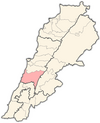
Baadarâne
Baadarâne
بعدران | |
|---|---|
Town | |
 Remains of a palace in Baadarâne, Shouf, Lebanon | |
| Coordinates: 33°38′10.3″N 35°37′08.9″E / 33.636194°N 35.619139°E | |
| Country | |
| Governorate | Mount Lebanon Governorate |
| District | Chouf District |
| Lowest elevation | 1,050 m (3,440 ft) |
| Time zone | UTC+2 (EET) |
| • Summer (DST) | UTC+3 (EEST) |
| Dialing code | +961 |
Baadarâne (Arabic: بعدران Baʿdarān), is an area in Chouf, Mont Liban, Lebanon.[1] Baadarane is 60 kilometres (37 mi) away from Beirut at an elevation of 1,050 meters .[2][3]
Baadarane is a town with an elevation of 1050m. It is known for the remains in al (Meydan) which is an old building and is located on a mountain so the weather is cold and especially in winter, snow covers the town.
Airport[edit]
The area is home to an abandoned airfield built during the Lebanese Civil War but never operated as active aerodrome.[4] The concrete runway is the only visible infrastructure.
References[edit]
- ^ Baadarâne Around Guides
- ^ Baadarane Geoview
- ^ Localiban (2015). "Baadarane". Localiban. Data center on local development in Lebanon. Retrieved 6 July 2015.
- ^ "Open Graph. City Guide". Beirut.com. Retrieved 28 December 2022.


