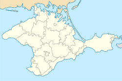
Vyshneve, Crimea
This article needs additional citations for verification. (June 2024) |
Vyshneve
| |
|---|---|
 | |
| Coordinates: 45°1′40″N 34°20′12″E / 45.02778°N 34.33667°E | |
| Country | Disputed: |
| Autonomous republic | Crimea (de jure) |
| District | Bilohirsk Raion |
| Population (2014)[1] | |
| • Total | 249 |
| Time zone | UTC+2 (EET) |
| • Summer (DST) | UTC+3 (EEST) |
| Postal code | 97633 |
| Area code | +380 6559 |
 | |
Vyshneve (Ukrainian: Вишне́ве; Crimean Tatar: Vişnövoye; Russian: Вишнёвое) is a village in Ukraine, located in the Bilohirsk Raion of the Autonomous Republic of Crimea. It is a part of the Krymska Roza Rural Council. The village is situated in the western part of the district.
Demographics[edit]
According to a 2014 census, the village had a population of 249 people.[1]
| Year | 1915[2] | 1926[3] | 1989[4] | 2001[5] | 2009[6] | 2014[1] |
|---|---|---|---|---|---|---|
| Population | 29 | 35 | 120 | 259 | 313 | 249 |
Native languages[edit]
The following table displays the reported native languages of the 259 residents who responded to the 2001 Ukrainian census:[7]
| Language | Percentage |
|---|---|
| Crimean Tatar | 65.80% |
| Russian | 30.48% |
| Ukrainian | 1.86% |
| Belarusian | 0.37% |
References[edit]
- ^ a b c "Таблицы с итогами Федерального статистического наблюдения "Перепись населения в Крымском федеральном округе"". gks.ru (in Russian). Archived from the original on 25 September 2015. Retrieved 9 June 2024.
- ^ ИнфоРост, Н. П. (1915). Статистический справочник Таврической губернии : Ч. 1 Статистический очерк Таврической губернии. Ч. 2. Список населенных пунктов по уездам: Бердянскому, Днепровскому, Мелитопольскому, Перекопскому, Евпаторийскому, Симферопольскому, Феодосийскому и Ялтинскому (in Russian). Simferopol. p. 10. Retrieved 9 June 2024.
{{cite book}}: CS1 maint: location missing publisher (link) - ^ Список населенных пунктов Крымской АССР по всесоюзной переписи 17 декабря 1926 года (PDF) (in Russian and Crimean Tatar). Simferopol: Crimean Central Statistical Office. 1927. p. 144. Retrieved 9 June 2024.
- ^ Музафаров, Р. И. (1993). Крымскотатарская энциклопедия (in Russian) (1 ed.). Simferopol: Vatan. p. 424.
- ^ "Table: 19A0501_07_001. Number of actual population in rural areas, Avtonomna Respublika Krym (1,2,3,4)". db.ukrcensus.gov.ua. Retrieved 9 June 2024.
- ^ "Український видавничий портал - who-is-who.ua". who-is-who.ua (in Ukrainian). 2009. Archived from the original on 31 October 2014. Retrieved 9 June 2024.
Площадь 64 га, население 313 человек. количество дворов 75.
- ^ "Table: 19A050501_02_001. Distribution of the population by native language, Avtonomna Respublika Krym (1,2,3,4)". db.ukrcensus.gov.ua. Retrieved 9 June 2024.


